 Photo: Wikimedia Commons
Wicklow Mountains National Park
Co. Wicklow · 2 hours to full day depending on activity
Wicklow Mountains National Park covers 20,483 hectares of the Wicklow uplands — one of the largest continuous areas of upland blanket bog in Ireland. The landscape is a classic post-glacial one: rounded granite peaks, steep-sided glacial valleys (glens), long finger lakes, and rivers running fast over exposed rock. The Lugnaquilla (925 m), Tonelagee (817 m) and Djouce (725 m) peaks form the high ground. The upper Liffey valley, the Sally Gap plateau and Glenmalure are the wildest sections.
Its main rivers are the Avonmore and Avonbeg, which converge at the Meeting of the Waters in the Vale of Avoca to form the Avoca. The woodland remnants in the lower glens are some of the most diverse in Ireland, with sessile oak, birch, rowan and holly forming the upper canopy and a rich ground flora beneath. Red deer, red squirrel and peregrine falcon are all present.
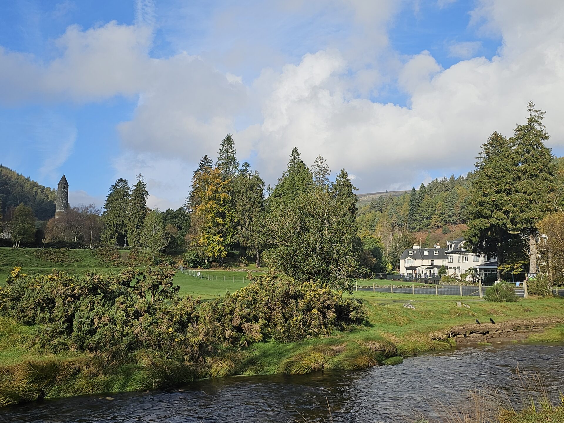
Glendalough (covered separately) is the most visited part of the park, but the high mountain sections — accessible from the Sally Gap or Military Road — are largely empty on all but the best weekends. The Wicklow Way long-distance walking route (132 km) passes through the park from north to south, taking in the main peaks and valleys.
Highlights
- The Sally Gap — an exposed crossroads on the high plateau, peat bog and granite in every direction with virtually no visitors midweek
- Glenmalure — the longest glacial valley in Ireland, accessible by a single-track road with no facilities and real mountain character
- The Military Road — built by the British after the 1798 Rebellion to suppress guerrilla activity; follows the mountain spine for 50 km
- Lugnaquilla (925 m) — highest peak in Leinster, a full-day route from Glenmalure with excellent views across four provinces
- Powerscourt Waterfall (separate ticket) — Ireland's highest waterfall at 121 m, in the foothills of the northern park
Good to know
- →The Sally Gap area is easily driven — take the R115 from Enniskerry or Kilpedder for a loop through the high ground.
- →Glenmalure requires a car — there is no bus service and the valley road is single-track.
- →Weather changes fast on the high ground. Bring waterproofs even on a clear day in Dublin.
- →The St Kevin's Bus serves Glendalough from Dublin if you don't have a car — doesn't reach the wilder sections.
- →Weekdays are dramatically quieter than weekends. If you can visit midweek, the park feels genuinely remote.
Best Time to Visit
May–Jun for wildflowers and rhododendrons near Glendalough; Sep–Oct for bracken turning gold along the Sally Gap road. Avoid the Military Road on bank holiday weekends when it becomes congested. Lugnaquilla summit walk is best Jun–Sep.
Getting There
Common questions
How close are the Wicklow Mountains to Dublin?
The northern edge of the Wicklow Mountains National Park begins about 20km from Dublin city centre — 30 minutes by car. Glendalough, the most popular destination within the park, is 50km from Dublin (about 1 hour). The proximity makes Wicklow the primary day-trip natural landscape for Dublin visitors.
What is the best walking in the Wicklow Mountains?
The Glendalough valley (lakes and monastic ruins) is the most popular and rewarding day out. The Wicklow Way long-distance trail passes through the park and can be walked in sections. The Sally Gap and Glenmacnass Waterfall are worth seeing by car. Lugnaquilla (925m) is the highest point and a full-day mountain walk for experienced hikers.
Is there public transport to the Wicklow Mountains?
St Kevin's Bus Service runs from Dublin city centre (Camden Street) to Glendalough twice daily — book online in advance as it fills quickly in summer. For the wider park, a car gives much more flexibility. The Wicklow Cycling Route and the Military Road (R115) give access to the high moorland.
What is the Military Road in Wicklow?
The Military Road (R115) was built by the British between 1800 and 1809 to give access to the Wicklow Mountains during the aftermath of the 1798 rebellion. It runs from Rathfarnham on the Dublin edge to Aghavannagh in south Wicklow, crossing the high moorland via the Sally Gap and Glenmacnass. It is one of the great scenic drives in Ireland.
Where to Stay


Nearby Attractions


Planning your visit
Free entry — no ticket needed. Add this stop to your Ireland route.
Add to your trip planPlan your full Ireland itinerary
Quick Facts
- Type
- Nature
- County
- Co. Wicklow
- Province
- Leinster
- Entry
- Free
- Hours
- Year-round (no entry fee; car parks have charges at Glendalough)
- Allow
- 2 hours to full day depending on activity
Destination guide
Dublin & Day Trips
Itinerary, best stops and local tips for Dublin & East · Ireland.
Read the guide →
← All attractions